Hello everyone! In 2016, I decided to take the California Zephyr from Emeryville to Reno. Since I was getting into trains at the time, I thought...
The Surface Transportation Board has a map site that may be useful for railfanning and for finding historic rail structures at...
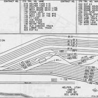
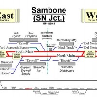
Track layout of Helper Yard as it appeared just after the DRGW and SP merger (1997).
This simpler version was originally used at Rick Fortin's ATSF 4th District layout http://fortinweb.com/swsf
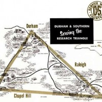
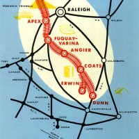
Durham & Southern (later Seaboard Air Lines, CSX) 1906-1979 map of routes, connections and stations
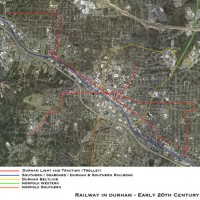
Durham NC rail systems, early 20th century - image from: endangereddurham.blogspot.com
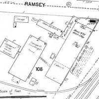
Carolina Furniture, Durham NC 1902 Sanborn Fire Insurance Map Showing main line and turnout into factory
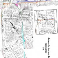
WT Blackwell & Co. Sanborn Fire Insurance map showing main line and turnouts into factory complex 1870's - 1987
This is an example of the maps that are posted on the backdrop or fascia near each town on Rick Fortin's ATSF 4th District HO layout.
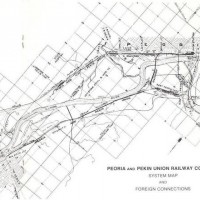
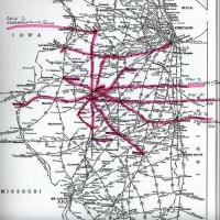
P&PU regional map showing the 12 RRs connecting with the P&PU in Peoria Illinois. There were regularly scheduled trains moving traffic...
Regional System Map showing trains/RRs that are served by the P&PU. Highlighted routes between Peoria/Pekin and the various cities on the map...